
1. The Start: The race will start on Potomac Road right at the Potomac Group Campground road entrance. 50K and 50Mile races start at 6:30am and the 25K will start at 8:00am. Runners will go down-hill (south) on Potomac Road for a bit over a quarter of a mile.
2. Hit the Trail: After running about a quarter mile down hill on Potomac Road, you’ll turn right onto one of the Potomac Trail spurs. This trail is pretty twisty-turny and leads you up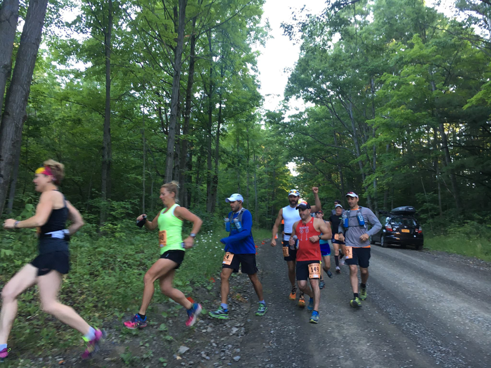 hill a bit to the first T intersection. At this intersection you’ll turn left onto Interloken Trail. After turning onto the Interloken Trail, you’ll go less than a quarter mile and cross Picnic Area Road. When crossing Picnic Area Road, you’ll run through small U-shaped dirt parking road with a small campsite to the right – you veer a bit to the left and pick-up the Burnt Hill Trail. This trail runs right beside a cow pasture fence, possibly some water and muck soup, and will take a few 90 degree turns – just stay on the trail.
3. The First Cow Gate: After about ¾ of a mile on the Burnt Hill Trail going south, you’ll encounter the first gate entering a cow pasture. You NEED to take care and CLOSE the gate – even if there’s another runner 30 meters behind you. We cannot let any cows out. You’ll continue due south on the Burnt Hill Trail through the first cow pasture and enter the “Cow Woods.” Through the “Cow Woods” we go and you’ll come to another gate – go through and CLOSE, then you’ll pop out of the Cow Woods onto a dirt road. You’ll turn left on this dirt road – Mark Smith Road.
4. Down, down, down to The Morgue: You’ll be on Mark Smith Road for about a mile to the next trail head, and you’ll be running down hill almost the entire time. And, you guessed it: what goes down must go up. After pounding downhill and coming to the bottom of Mark Smith Road, you’ll come to The Morgue Aid Station (Aid Station #1). At the Morgue, you’ll take an immediate right turn back onto the trails – this is the Gorge Trail. This is one of the most beautiful sections of the course – and yes, you’ll be going mostly uphill, down into a wonderful gorge, and heading back uphill crossing a few small streams.
5. Two-way Traffic: After running nearly a mile uphill on the Gorge Trail, you’ll come to a trail sign – you go straight through this intersection, and if you’re a mid-packer or slower, you may encounter other faster runners coming back at you for only about a 300 meter section – stay to the left side of the trail. After running up a short hill, you’ll find another T intersection – stay to the left and go straight through this intersection at this intersection – the two-way traffic ends at this intersection – and you are now back on the Interloken Trail.
6. South Beach #1: After staying left on the trail and continuing on the Interloken Trail, you’ll go about another half a mile and you’ll come to the South Beach Front Aid Station – and, no, it ain’t in Florida. This is aid station #2 on the course. DO NOT walk to the road side of the aid station – stay on the trail side of the aid station and as you leave South Beach you’ll run around the edge of a pond continuing on the Interloken Trail.
7. Mud, and don’t step on the newts: Shortly after entering the woods after the pond, you’ll be encountering intermittent muddy sections of trail, and possibly encountering red newts. But, hold onto your shoes, because it’s not the muddiest section of the course. This section will twist and turn through the woods and go through a pine tree grove with lots of roots. A little over a mile from the South Beach Aid Station #1, the trail will turn 90 degree to the right. Soon after this turn, you’ll find a trail sign on your right – this is the indication you’re about to step foot on the famous Finger Lakes Trail – part of the North Country Trail that goes all the way to North Dakota. But, don’t worry, you’re not running that far. Just after the sign post you’ll turn right to keep on the Finger Lakes Trail.
8. Nice!: The Finger Lakes Trail section of the course is probably my favorite section and a beauty too. Enjoy! You’ll come to Burnt Hill Road, a dirt road. Cross the road at a slight angle and go through a tri-post stile to stay on the trail. This is where the trail is really beautiful. You’ll twist through a spread-out woods and cross two creeks on nice, well-built bridges. Just after crossing the second bridge you’ll turn 90 degrees to the right off of the Finger Lakes Trail and onto the South Slope Trail. You’ll go through a short wooded section and into the South Slope field going slightly uphill. Stop and smell the flowers if you want – but don’t let anyone pass you!!
9. Dirt in your teeth: You’ll cross a narrow stream and you continue gently uphill and reach Burnt Hill Road where you’ll turn left. Don’t be surprised if you get passed by vehicles on this dirt road stirring dust – be aware of traffic. After about a third of a mile going north on Burnt Hill Road, follow the road as it veers right. Go another quarter mile and you’ll encounter the South Beach Back Aid Station – aid station #3 on the course. After some water and electrolyte drink, you’ll continue for another couple hundred yards or so north on the dirt road. Look for a campground on your right and look for the arrows and pink flags as you’ll turn right and run directly through the campground. Through the campground you’ll go, you’ll immediately come to a pond – go around the pond and continue on the trail – you are now back on the Gorge Trail.
10. Two-way traffic – again: After going through the campground and around the pond, you’ll go about another 300 metes and come to a T intersection – turn left and stay to the left on the trail. If you’re in the front end of the race, you’ll encounter mid-packers and slower runners coming at you coming up from The Morgue Aid Station on the Gorge Trail. In about 200 meters, you’ll encounter another T intersection with a trail sign – here you turn 90 degrees to the left onto the Interloken Trail (if you go straight here, you’ll go down the Gorge Trail and back to The Morgue Aid Station – this is the wrong direction).
11. Twisting Up: Once you turn left onto the Interloken Trail, you’ll twist you’re way up a long gradual hill that seems to go on, well, not forever, but close to it. You’ll come to an opening and cross the Burnt Hill Trail – go straight and make sure you stay on the Interloken Trail. You’ll continue uphill slightly, cross several boardwalks and then come to Matthews Road.
12. “Mooooo”: When you come to Matthews Road, go straight across the road and you’ll encounter another cow gate. Go through the cow gate – and CLOSE the gate. Here, you’ll pass a lonely apple tree and a beautiful scene toward Seneca Lake, both on your left. But, watch your step, you’ll want to keep a look-out for those fresh cow pies. But more importantly, you’ll want to watch out for the cows. Through the cow field (what we call Siberia because in the winter the wind really whips through this hill top feeling like Siberia), go down a slight slope and possibly some mud (well, you’d like to think it’s mud but remember cows live here!!) and come to another gate. Go through the gate and CLOSE the gate. Continue on the Interloken Trail.
13. The Library: Continuing on the Interloken and crossing a couple streams and boardwalks, you’ll come to a T intersection with arrows and pink flags – here you’ll take a very sharp left turn onto the Ravine Trail. You’ll go down a lovely hill and you’ll be most tempted to pick up your pace here – it’s a nice section of trail. At the bottom of the hill you’ll come to Burnt Hill Road and to The Library – no, not an actual library, but aid station #4, The Library. Continue through the aid station and back onto the Ravine Trail. You’ll continue down hill and into the ravine – a beautiful rocky section of trail – make sure you look out for course markings and you footing during the steep descent into the ravine. There is some really tricky footing going down this ravine with roots and a cliff – watch your step. You’ll encounter a twisty creek that you’ll cross easily without getting your feet wet – maybe a little wet. After crossing the creek, you’ll go up a hill through a section of woods and then along a pine tree grove. Soon after the pine tree grove, you’ll come to a paved road – this is Picnic Area Road. Turn right onto Picnic Area Road and follow the quarter mile of pavement. As you run slightly uphill, you’ll see signs for the Horse Camp on the left – turn left and go down the driveway to the trail – The Backbone Trail.
14. Mud, more mud, possibly horses,… and more mud: Even though you’ve encountered mud on the course already, and possibly lots of mud, this historically has been the muddiest section of trail on the course. This is the Backbone Trail and is also a horse trail. If you see a horse either coming at you or you coming up from behind, make yourself known – yell hello or something well before so the horse doesn’t get started and buck the rider. If it’s been even slightly rainy before the race, this section may suck your shoes off if you don’t watch your step. You’ll spend about a half mile dodging muddy sections of trail, but then you’ll come to a slight down hill into a lovely gorge and stream crossing, go up a hill, and back into a short muddy eroded section of trail. Just up the hill you’ll come to a T-intersection. You’ll continue straight ahead on the Backbone Trail—don’t turn.
15. The Oven: Once you pass this T intersection, you’ll have a mile of trail that is open to the sky. And, if it’s a clear, sunny day, it will feel like an oven. But at the end of the this trail up a slight hill, you’ll feel like you just ran through the back-forty, but really, you just ran to the Outback Aid Station – aid station #5.
16. Deceiving: After hitting the Outback Aid Station – you’ll turn right and go through a cow 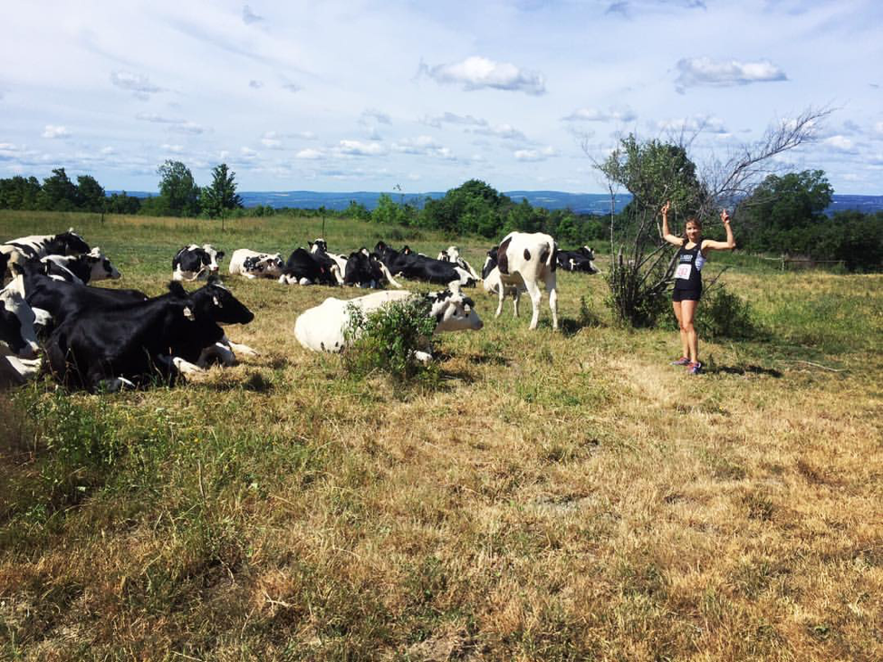
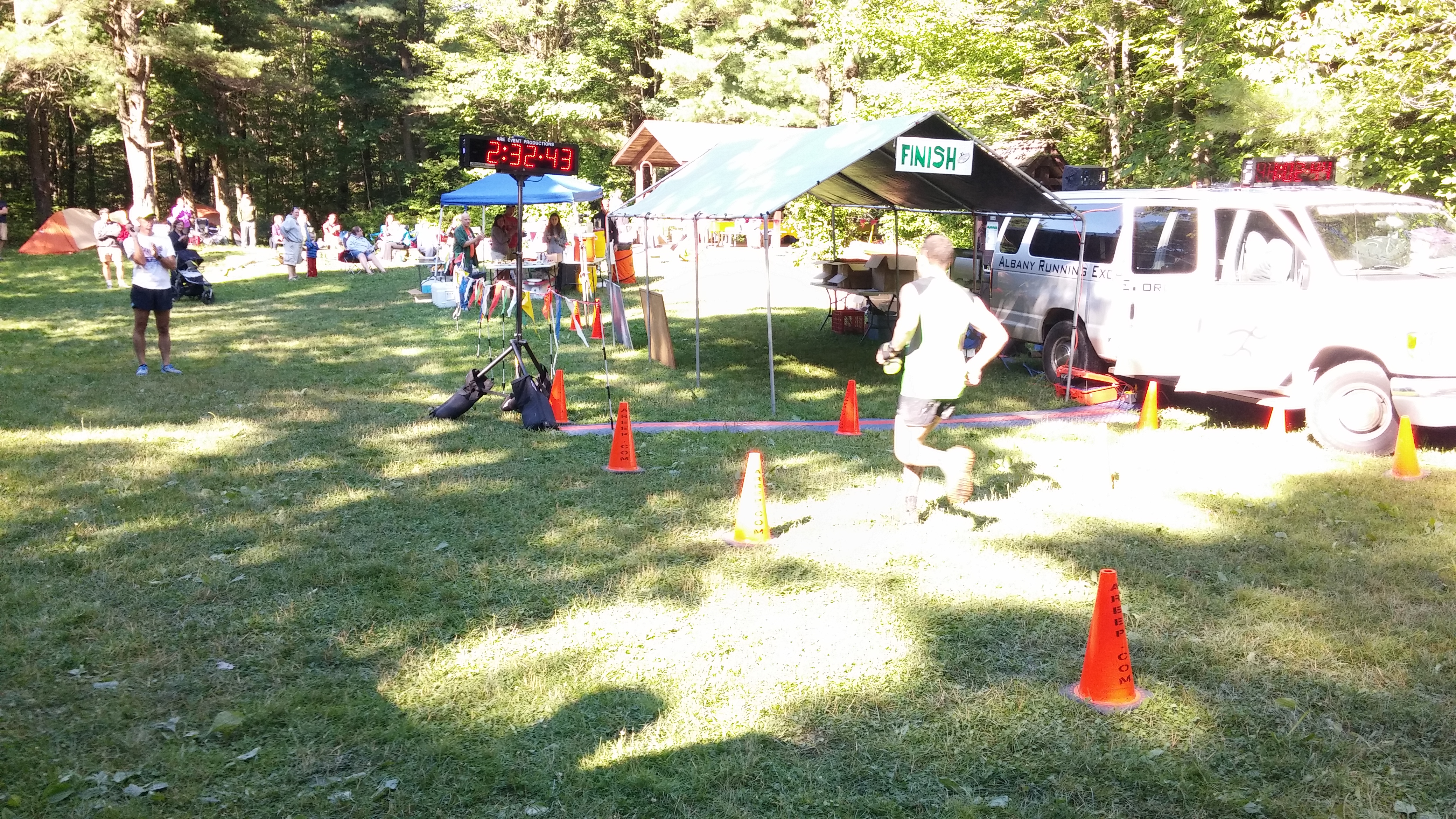
17. The homestretch: Diversity: You’ll continue directly south on the Interloken Trail. You’ll encounter all kinds footing on this twisty-turny trail, especially roots. This section is near the end of the loop, so make sure you concentrate on picking those feet up. You’ll run through wonderful woods, two stately pine tree groves, and a few boardwalks with broken, wavy, and bouncy boards. Again, watch your step. After a bit over a mile on the Interloken Trail, you’ll come to the beautiful and popular Foster Pond. You may see people enjoying a swim and/or fishing here. You’ll continue around the pond, up a short hill and cross Potomac Road. Here you’re almost to Race Headquarters. After crossing Potomac Road, the trail is a bit twisty and very rooty. Then you’ll come to a pond on your right, and then another larger pond – these are the Wildlife Ponds. Go around the larger pond and continue on the grassy path and you may hear the finish line area crowd and some rockin’ tunes blasting from the PA, and then you’ll pop out to…..
18. The Living Room: Aid station #6, Race Headquarters, the finish line/chip mat area, and beer!
If you’re running the 25K you’re done – go across the finish line. You’re awesome!
If you’re running the 50K or the 50-mile you get to do it all over again. Go through the Living Room Aid Station, come to a T – take a left down hill on the rocky trail, cross the creek at the bottom and you’ll come to Potomac Road. Go straight across the road and you’ll encounter the first trailhead you came to at the very start of the race.
19. Are you done yet?: After you do the second loop, and if you’re doing the 50K – you’re done! Cross the finish line. You’re awesome!
If you’re doing the 50-mile, it’s “déjà vu all over again” for the third loop.
20. The Baby Loop: After you complete the third loop and come to the Living Room for third time… you ain’t done yet! You have the half-mile Baby Loop to complete. Think of this as your victory lap—it’s all easy footing, completely flat, and pleasantly short. Go through the Living Room Aid Station and when you get to the T intersection, instead of turning left down the trail, you’ll turn right and you get to the Potomac Group Campground parking lot. Go through the parking lot and along the driveway to Potomac Road – this is the start line area of the race. Turn right onto Potomac Road, go about 100 feet to the next parking area on your right, and take a sharp right onto the trail just past the kiosk. Continue on this trail and you’ll come to the large Wildlife Pond on the left that you’ve already encountered on the course – take a right just after the pond and back to the Living Room Aid Station. Listen to the crowd call you in and cross the finish line. NOW you’re done!
Take note—there are cows out there:
There are cows in all three of the pastures that you will be running through. When you enter a pasture you will be running straight across and will not make any turns. There will be gates on both ends of the pastures—make sure the gates are closed securely. This is very important … THE GATES MUST BE CLOSED BEHIND YOU as the cows cannot be let out of the pastures. PLEASE… if you know that there is someone behind you coming to the gate soon but they are not actually going through the gate at the same time as you, do not think you are being courteous by leaving the gate open for them—close the gate. An open, unattended gate leaves the chance for cows escaping and this absolutely cannot happen. Escapee cows will jeopardize future of this event.